 |
The earliest surviving plan showing the gardens of York House is dated 1784. This shows the boundaries of the gardens as being identical with those of today. |
The map of 1864 shows that the driveway from Church Street to York House had by then been more clearly defined and trees had been planted along the border with Sion Road and around the entrance to the driveway in Church Street. A number of trees had also been planted between the house and the vicarage to screen the view.
The Lodge which was shown to have stood at the junction of Sion Road and Richmond Road in 1784, where the present York Cottage now stands, had been demolished in 1846, possibly to accommodate this landscaping scheme.
The Ordnance Survey map of 1873 shows a much more sharply defined oval-shaped lawn in front of the house. By comparison with the map of 1846 the amount of planting on the east side of the house had also been considerably increased. A wide expanse of lawn immediately behind the main house ran down to the Riverside but the area of land between the Riverside and the Thames remained uncultivated.
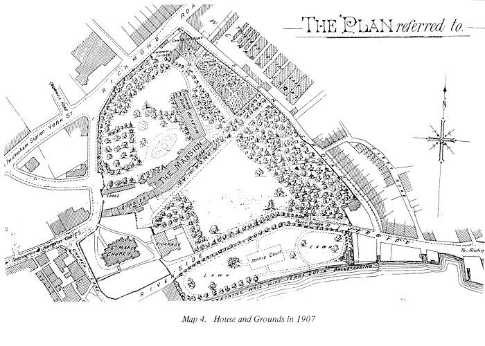
In 1898, with the arrival at the house of the Duc d'Orleans, far greater changes had begun to take place in the gardens. The entrance driveway had been enlarged to create a circle for carriages, and the open expanse of lawn in front of the house was being divided up by planting. This is the first map to show the present York Cottage, sited at the junction with Sion Road and Richmond Road.
By this date the formal gardens to the west had disappeared, being replaced by a path running parallel to the house. The Duc had the river bank wall rebuilt and when he added the Museum and Swimming Pool extension northwards from the house into the gardens, he arranged the surrounding paths and planting.
The map which accompanied the sale particulars in 1906 shows the extent of the improvements which the Duc had accomplished. He had by this time laid the Riverside Gardens to lawn - previously they were open grazing land - and had added both grass and asphalt tennis courts, together with a Summer House.
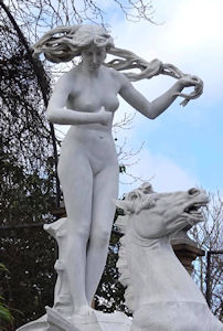
The biggest remodelling of the gardens came with the arrival in 1906 of Sir Ratan Tata. He created the sunken garden immediately behind the house and erected the walls surrounding it. He completely remodelled the Riverside Garden, when, in 1909, he purchased the magnificent group of marble figures which he placed at the Western end as a culmination of the axial plan we see today. (See The Statues)
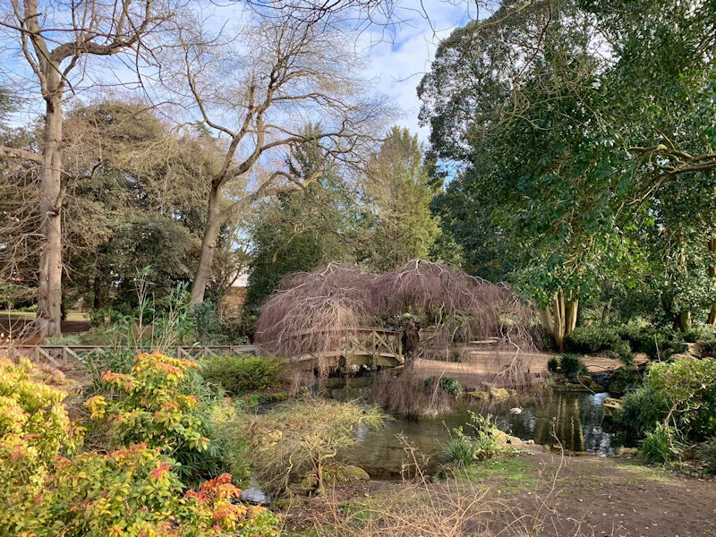
Sir Ratan Tata removed the rustic footbridge over Riverside, replacing it with the present stone footbridge in its new position, to provide access to the outer garden from the main house, and he created the present pond and Chinese bridge.
The pond and Chinese bridge. Photo by Brian Kerr
The map of 1924 shows a fountain in the area now used as the car park on the North West side of the house. This plan shows in the western corner of the garden, a circular brick paved area, probably created as the base for a statue that would have completed the axial view along the front of the house.
When Twickenham Urban District Council occupied York House in 1926, they introduced four tennis courts on the eastern side of the building, now accommodating the public halls, and re-landscaped the surrounding gardens.
For the story of the statues in the western end of the riverside gardens, see the Statues page.
